Geog' Clips videos
GCSE • IGCSE • A-level • IA-level • IB • National 5 • Highers • Leaving Cert
Coasts Geog' Clips
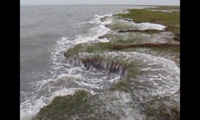
Waves attacking a salt marsh boundary
Geog' Clip: Wave-cut gullies incising the leading edge of a back-barrier marsh.
Relentless waves
Geog' Clip: Simple use of an iPhone 7 timelapse to get a better sense of how relentlessly the sea attacks the coastline
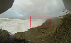

Storm of the century
Geog' Clip: Rare footage of hydraulic action at work. 6-8 m storm waves tearing cliffs apart during the UK winter storms of 2014
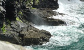
Blowhole and marine erosion at cliff-foot S of Tintagel Head, Cornwall - Hydraulic action
Geog' Clip: Waves crashing at the foot of cliffs south of Tintagel Head, Cornwall. An active blowhole is visible at the cliff-foot.

Timelapse of Atlantic swell waves
Geog' Clip: Atlantic swell waves breaking at Men-a-vaur, Tresco, Isles of Scilly, Cornwall, UK. Still carrying energy three days after Storm Brian.
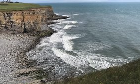
Llantwit Major, S Glamorgan, S Wales - Wave-cut platform
Geog' Clip: A view of the remarkable wave-cut platform between Col-huw Point and Pigeon Point near Llantwit Major, South Glamorgan, South Wales
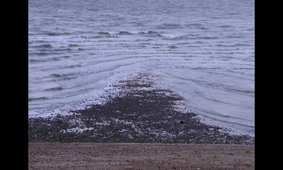
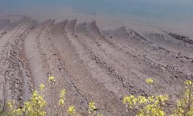
Seagull restaurant not quite open yet - wave refraction
Geog' Clip: Ebb tide waves refracting around a small area of shingle deposit near Whitstable Harbour, Kent
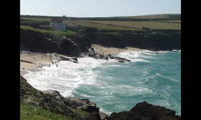
Surf at Mother Ivey's Bay, Cornwall x5
Geog' Clip: Wave fronts approaching Mother Ivey's Bay, Cornwall. Mesmerising Atlantic breakers reaching the coast of Cornwall x5.
Rivers Geog' Clips
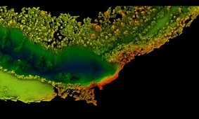
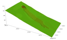
Waterfalls: From Drone to Data
Geog' Clip: A quick overview of how we can use drones to get useful information about the landscape
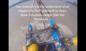
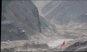
Eroding mountains into sand
Geog' Clip: Sediment sourced in the Himalaya is carried downstream by rivers - but what happens to it when it leaves the mountains?
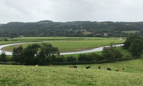
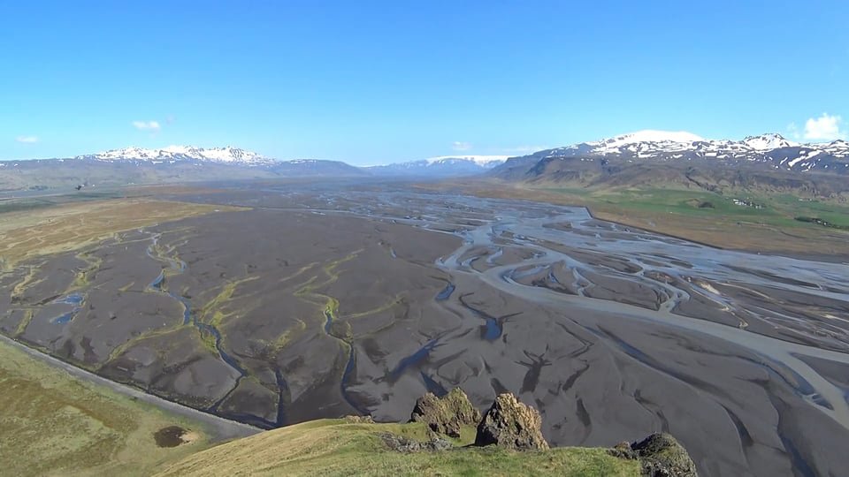
Huge curving meanders
Geog' Clip: Wide river meanders moving at 4 m per year, on the River Towy in South West Wales
How the landscape forgets a landslide
Geog' Clip: The UK 2014 storms triggered lots of landslides. Simulation of how this hillside will recover over the next 8000 years, through weathering and soil creep.