Waterfalls: From Drone to Data
Rivers Geog' Clip

Log in or sign up to manage your videos and for new video alerts
Log
in
Description
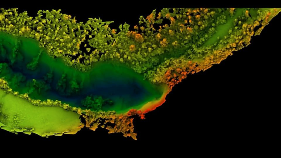
Many landscapes are hard to access for a number of reasons (steep slopes, distance from roads etc), which means that traditional surveying techniques are impossible to use. With drones, we can access and collect data from new and exciting places. In this video, we see a waterfall from a drone's perspective, as well as the high resolution 3D elevation data that can be produced from photos taken by the drone using a method called 'Structure from Motion'. With this data, lots of information can be calculated, such as the height of the waterfall and how much erosion the waterfall has caused as it retreats in an upstream direction.
Shared by: Edwin Baynes, @EdwinBaynes
Location: Makopua, New Zealand
Captured: 14/03/2017